
A new expedition searches for Amelia Earhart’s missing plane. Explore the evidence, radio navigation, sonar, satellites and key uncertainties.
A new search, an old question
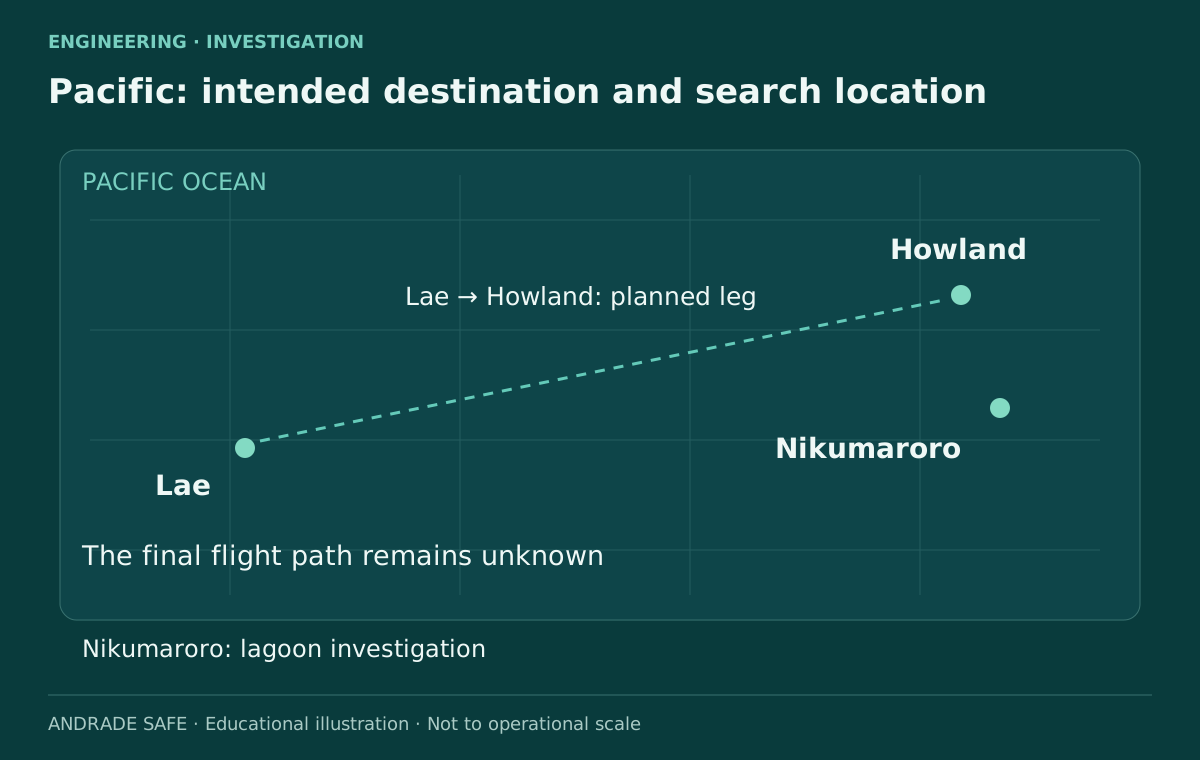
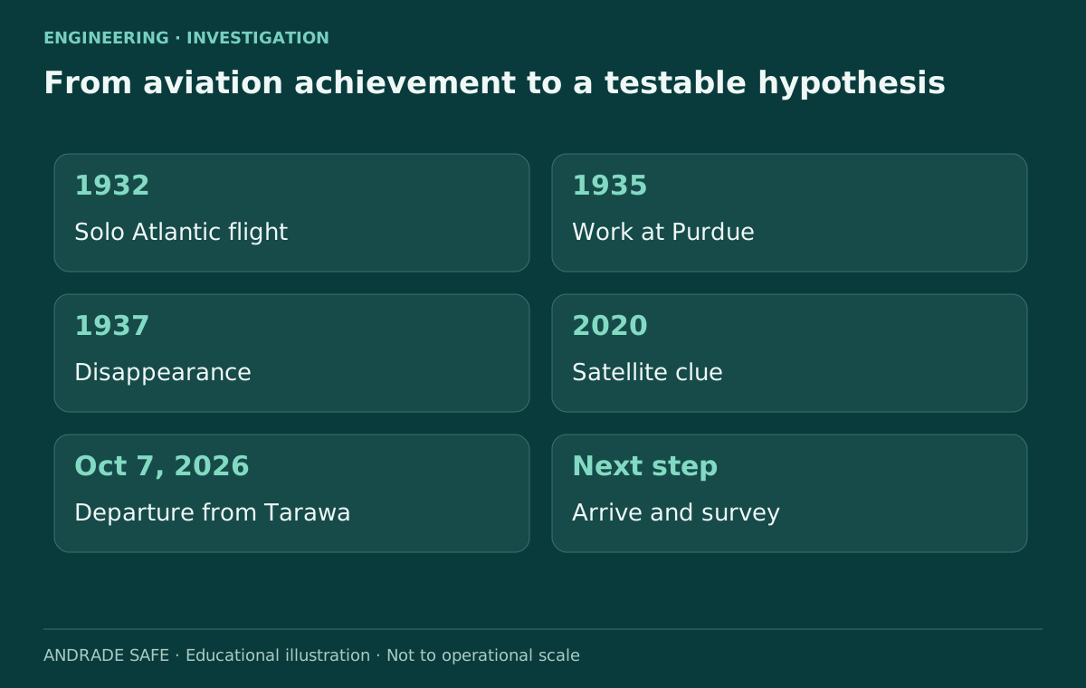
In July 1937, Amelia Earhart and Fred Noonan set out from Lae, New Guinea, for a tiny island in the Pacific: Howland. Their Lockheed Electra never reached its destination. Almost nine decades later, an expedition is crossing the ocean to test a lead in the lagoon at Nikumaroro. The investigation brings together aviation history, remote sensing and archaeology. It begins with a shape seen in images; its challenge is to establish what that shape actually represents.
Status checked on October 11, 2026: the official sources reviewed contain no announcement of a verified identification of the aircraft and no confirmation that the team has arrived. The latest update listed by the Purdue Research Foundation is dated October 9, when the vessel was still underway. That is the date of the latest report located, rather than a live observation of the ship’s present position.
The scientific value does not depend on a spectacular ending. Establishing that a lead has a natural explanation also produces knowledge, provided the result is documented. The useful question is not how much an image resembles an airplane, but which observations distinguish an airplane from other explanations. Curiosity draws us to the mystery. Engineering asks for evidence.
Latest official update located: Purdue, October 9, 2026 →
Historical photograph: collection, authorship and usage conditions →
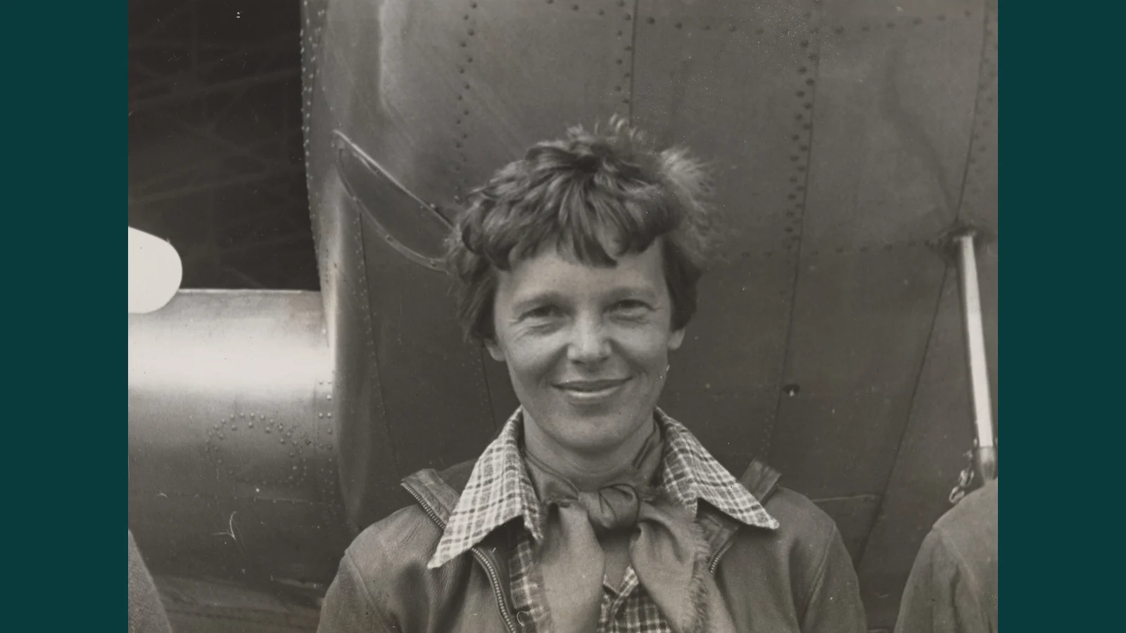
Who was Amelia Earhart before she disappeared?
Amelia Earhart was an aviation pioneer, writer and advocate for women’s opportunities. In 1932, she became the first woman to fly solo and nonstop across the Atlantic. The achievement required piloting skill, operational decisions and endurance at a time when long flights faced substantial limitations in instruments and infrastructure. Reducing her biography to her last flight obscures what she accomplished during her life.
In 1935, Earhart began working at Purdue as a career counselor for women and an adviser to its aeronautics department. Her connection to the university helps explain its involvement in the present search. The Purdue Research Foundation supported the purchase of the Electra used for her around-the-world attempt. Known as the Flying Laboratory, the aircraft linked the practical challenges of long-distance flight with an educational ambition.
The project reflected a desire to explore long-range aviation and expand its educational value. It is also the story of a woman entering technical spaces that remained difficult for other women to access. Preserving that legacy requires respect for records, people and historical context. Reporting on the search can be compelling without treating every anomaly as a discovery announcement.
Finding Amelia Part 1: Who Was Amelia Earhart?
Purdue University · This Is Purdue. English-language interview from the series published September 28, 2026; background and expectations, not proof of a discovery.
Source: Amelia Earhart’s Lockheed Vega 5B →
Source: Finding Amelia — official series →
Watch on the official channel: Finding Amelia Part 1: Who Was Amelia Earhart? →
The last flight: why was Howland so difficult to find?
On July 2, 1937, Earhart and navigator Fred Noonan departed Lae for Howland, a planned refueling stop. The difficulty was physical: locating a small piece of land after many hours over water, with few visual references. Winds different from those anticipated could shift the aircraft’s position and change the flight time. Without a continuously confirmed position, uncertainty builds along the journey.
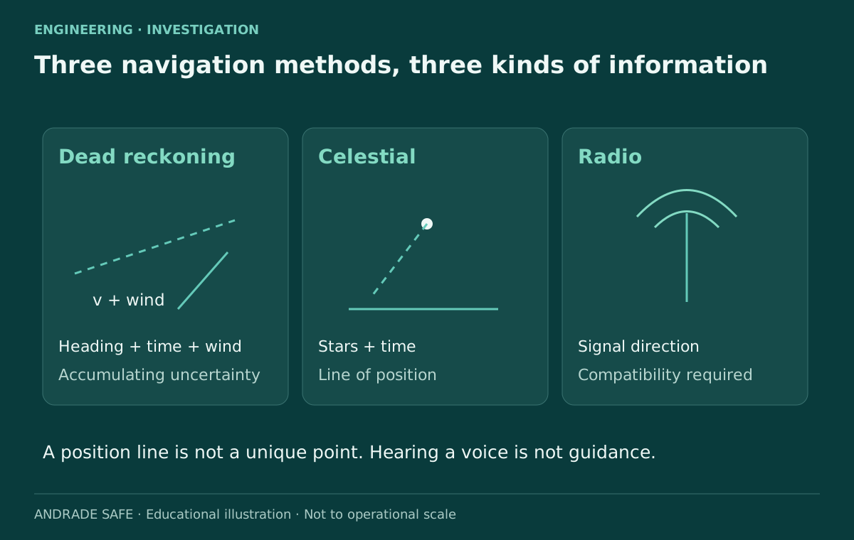
Dead reckoning combines an earlier position with heading, speed, elapsed time and estimated wind. Celestial navigation uses observations of celestial bodies, timing and calculations to establish lines of position. Radio direction finding seeks the direction of a radio signal. These methods complement one another, and each has limitations. A line of position narrows the possible location of the aircraft, but on its own it does not establish one unique point in the ocean.
The ship Itasca received messages from Earhart near the final part of the leg, but effective two-way communication that could guide her to the island was not established. Hearing somebody’s voice does not show that they can hear the replies or obtain a usable bearing. Radio equipment, procedures, frequencies and interpretation must operate as a system. The historical records support discussion of that vulnerability; they do not justify a certain reconstruction of the flight’s final minute.
Source: Amelia Earhart — collection and history →
Source: Amelia Earhart: Missing for 80 Years, but Not Forgotten →
The Electra and the limits of endurance
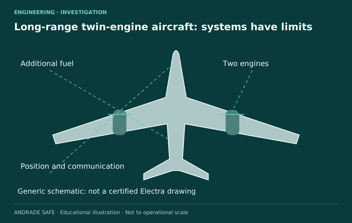
The Lockheed Model 10-E Electra was a twin-engine aircraft adapted for long-distance travel. Carrying additional fuel did not give it unlimited endurance: weight, performance, consumption, wind and reserves remained connected. The fuel supply had to support both the journey and the effort to locate the destination. Searching for an island consumes time and energy at precisely the point when an uncertain position has already become a critical operational problem.
That relationship can be explained without inventing flight data. In a generic example, a headwind reduces groundspeed for a given flight condition and extends the time required to reach the destination. Its actual effect on fuel consumption depends on the aircraft and how it is operated. This physical explanation does not establish the wind on each part of Earhart’s route or the amount of fuel remaining when the aircraft disappeared.
Two engines did not guarantee a safe outcome either. Propulsion redundancy cannot replace position information, communication or fuel. Different barriers address different threats, and they may share dependencies. The illustration in this article is an educational diagram of a twin-engine aircraft, without scale or the status of a certified Electra drawing. It is neither a reconstruction of wreckage nor a record of an inspection of the historical aircraft.
What is the Taraia Object Expedition investigating in 2026?
The mission brings together the Archaeological Legacy Institute, Purdue Research Foundation, Purdue University and representatives of Kiribati, among other participants. Purdue’s October 7 release lists 17 expedition members with different roles. This does not mean 17 divers: the team includes archaeology, technology, safety, local representation and documentation. The group departed Tarawa aboard the Marin Mainiku to examine an anomaly in the lagoon at Nikumaroro.
The Taraia Object was noticed in a 2020 satellite image. Organizers report correspondences with earlier aerial photographs, including records from 1938. That interpretation informs the choice of a survey target, but does not establish its composition or identity. The announced sequence includes drone reconnaissance, sonar, magnetometers and a localized investigation, with hydraulic dredging envisaged. These are planned methods, not findings already obtained.
The arrival forecast also needs careful reading. On October 9, Purdue indicated October 12, local time; Reuters reported October 13 on October 10, also as local time. The texts do not support attributing the difference solely to time zones. They are differing logistical estimates. Reporting an arrival as fact requires a fresh, verifiable update.
Finding Amelia Part 4: The Search for Amelia Earhart’s Missing Plane
Purdue University · This Is Purdue. English-language interview from the series published September 28, 2026; background and expectations, not proof of a discovery.
Source: Purdue — crew at sea and expected arrival →
Source: Purdue — departure from Tarawa and expedition team →
Source: Official Taraia expedition website →
Purdue: episode 4 — The Search for Amelia Earhart’s Missing Plane (on the series page) →
| Question | Record checked on October 11, 2026 | Limitation |
|---|---|---|
| Team | 17 members in the October 7 release | Different roles; not all are divers |
| Latest official update located | October 9: vessel still underway | Not a current live position |
| Forecast arrival | October 12 Purdue; October 13 Reuters, both local | Estimates; arrival unconfirmed |
| Taraia Object | Anomaly under investigation in the lagoon | Aircraft not identified |
| Methods | Drone, sonar, magnetometer and dredging planned | No confirmed field results |
An aircraft, a tree or something else?
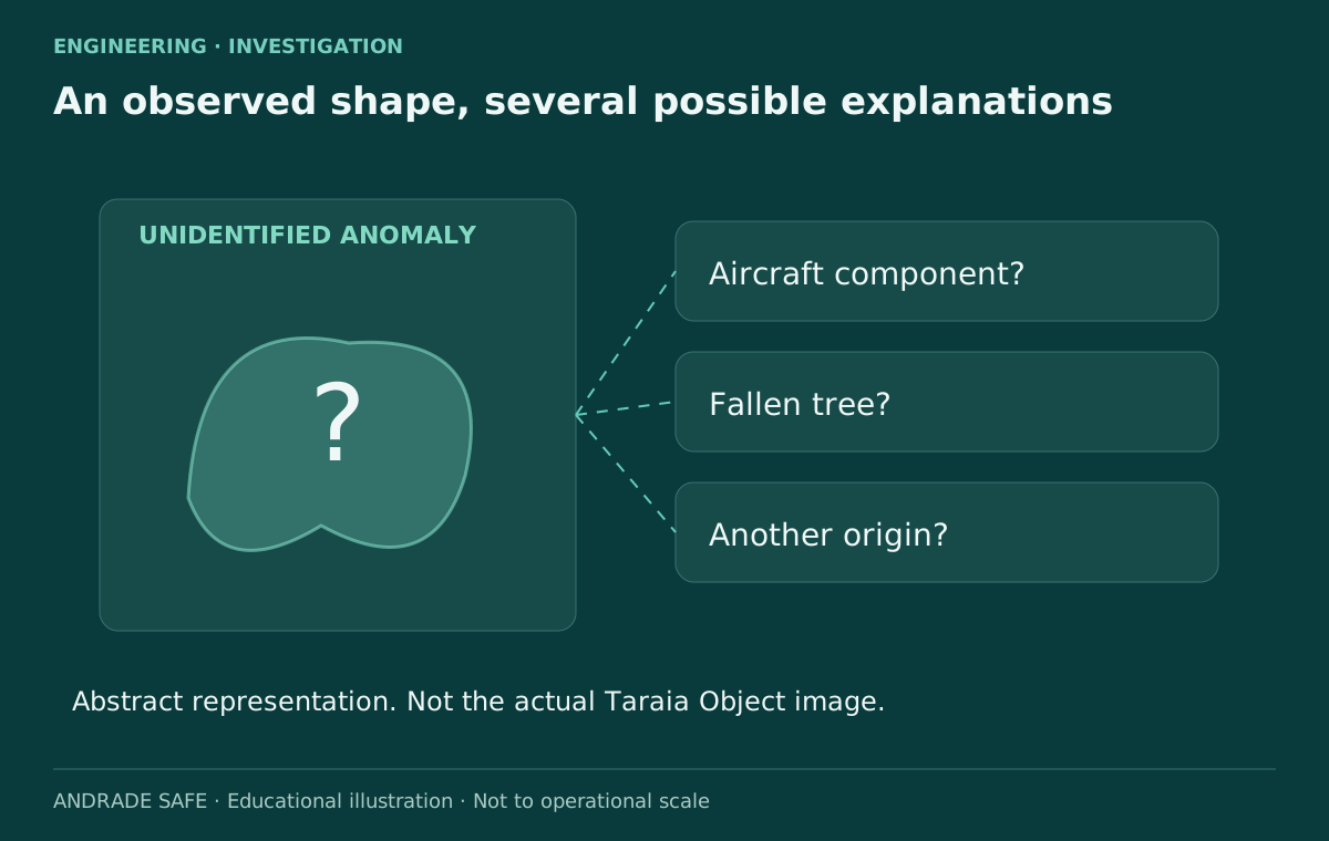
Organizers consider the shape potentially consistent with aircraft components. Ric Gillespie, a researcher associated with the Nikumaroro hypothesis, told Reuters that he interprets the object as a pandanus tree that fell into the lagoon. The disagreement is instructive: supporting a historical hypothesis does not oblige a researcher to accept every lead advanced in its name.
Pareidolia is the tendency to recognize familiar shapes in ambiguous stimuli. Confirmation bias arises when we look only for information that supports an idea. These mechanisms do not make images useless, but explain why visual interpretation needs controls. Comparing imagery against independent expectations and testing alternative explanations is more useful than increasing confidence because the same photograph has circulated repeatedly.
Spatial resolution, reflections, turbidity, tides, camera orientation and sediment can alter the observed appearance. Digitally enlarging an image does not automatically recover details that the sensor never recorded. A historical image series may help assess persistence and change, but aligning different images can introduce errors too. The abstract representation in this article does not reproduce the actual target. It explains why seeing a silhouette and identifying a material are separate stages in an investigation.
Source: Amelia Earhart expedition heads to a Pacific atoll →
How do the sensors work together?
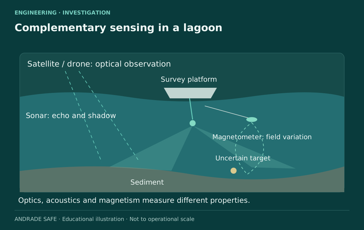
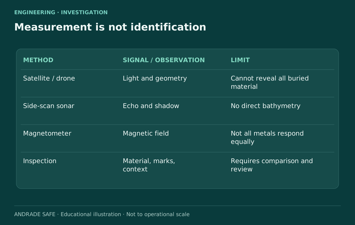
Drones support reconnaissance and documentation in places that are difficult to access. Overlapping photographs can assist photogrammetry when scale, geometry and references are controlled. Satellites provide wider context and allow comparisons over time. In both cases, optical observation depends on visibility conditions. An ordinary drone does not act as an X-ray machine that reveals components beneath sediment.
Side-scan sonar sends acoustic pulses and arranges their echoes into an image of the seabed. Return strength and acoustic shadows help outline objects. This is neither an optical photograph nor an automatic identification. A rock also creates an echo and a shadow. As NOAA explains, side-scan sonar does not directly provide bathymetry: depth measurements require complementary instruments.
A magnetometer measures variations in the magnetic field. In underwater archaeology, it can help locate ferromagnetic materials, including those buried beneath sediment. It is not a universal metal detector: aluminum does not respond like iron or ferromagnetic steel. An anomaly may arise from geology or another artifact, and cannot by itself reveal a maker or model. Combining methods reduces ambiguity because each sensor responds to a different property. Even coincident signals still require inspection and identification.
| Method | What it observes or measures | What it cannot establish alone |
|---|---|---|
| Satellite and drone | Light, apparent geometry and context | Buried material or aircraft identity |
| Side-scan sonar | Echoes and acoustic shadows | Model, registration or direct bathymetry |
| Magnetometer | Local variations in the magnetic field | Every metal; aluminum like iron; serial numbers |
| Inspection and documentation | Material, dimensions, markings and context | Provenance without comparison and independent analysis |
From echo to artifact: preserving context
Detecting a target begins the archaeological process; it does not complete it. Position, orientation and relationships with surrounding materials can help explain an object’s origin. Detailed photographs, measurements, drawings and georeferenced records allow another team to assess an interpretation. Removing an object before recording its context may erase part of the information needed to understand it.
This is a general explanation of method, not a report of expedition discoveries. An intervention using a hydraulic dredge needs control and documentation: sediment, exposed materials and changes to the site belong in the record. The technique does not turn an uncertain target into an aircraft component. Similarly, a component compatible with aviation does not automatically establish that it belonged to the specific aircraft being sought.
Conservation is another consideration. Submerged materials can deteriorate rapidly after removal, and stabilization requires specialist planning. The mission operates under Kiribati’s sovereignty. According to Reuters, Steve Schultz said that removing any wreckage would require additional authorization and would not occur on this trip. Identification, conservation and transfer are separate decisions. The interest of foreign institutions does not displace local authority over heritage or the operation.
What would it take to verify a discovery?
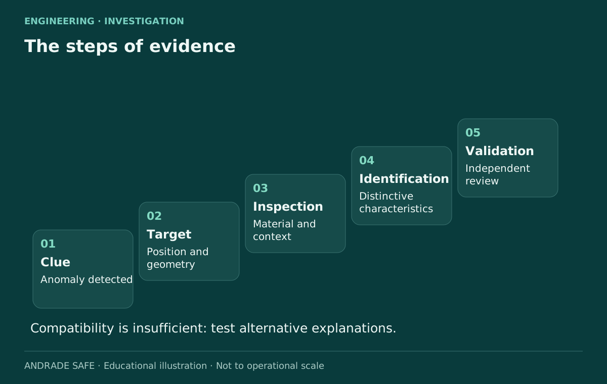
First, the target must be defined and the survey made reproducible: its position, conditions, instruments and data should permit review. Material and geometry then require inspection. A component must be described by the characteristics it actually shows, rather than by the object the team hopes to find. Corrosion, fragmentation and covering materials may conceal distinguishing features and limit the conclusion that can be supported.
Construction details, inscriptions, identifying numbers and matches with historical documentation can narrow an identification. Not every mark distinguishes one particular aircraft: components may be shared across models or replaced during operational service. A readable number with a documented connection has a different evidentiary value from a generic similarity of shape. Identification depends on converging evidence and on the alternative explanations examined.
Finally, the analysis must be available for independent validation. This does not mean a discovery exists only after international headlines; it means specialists must be able to test the relationship between data and conclusion. An anomaly, a target, an artifact, an aircraft component and Earhart’s Electra represent different evidentiary levels. A trustworthy investigation states which level it has reached and does not climb the steps through enthusiasm. An inconclusive result deserves publication with its limits too.
Howland and Nikumaroro: different hypotheses
Given the known facts, the Smithsonian considers it most plausible that Earhart and Noonan failed to locate Howland, exhausted their fuel and went down in the Pacific. This is a historical assessment, rather than a demonstrated location of the wreckage. The Nikumaroro hypothesis proposes a different ending and motivates surveys around the atoll. The new Taraia target is a specific attempt to test a lead within that second line of investigation.
Artifacts and accounts associated with an island require provenance, dating and a demonstrable connection to the people or aircraft. Compatibility with the 1930s may be relevant, but is not the same as exclusivity. A well-documented historical chain separates evidence from coincidence. Stories of espionage, capture or secret survival without verifiable support do not deserve the same weight as interpretations grounded in records.
Taraia should also not be confused with the sonar image released by another team in 2024. Reuters reports that the earlier aircraft-shaped target proved to be a rock formation. The locations, equipment and initiatives are different. That episode shows why a promising shape requires another check; it does not prove that every future search will fail. Learning from a false positive improves the question asked of the next target, provided the circumstances are kept distinct.
Source: Amelia Earhart — collection and history →
Source: Amelia Earhart expedition heads to a Pacific atoll →
What can engineering and occupational safety learn?
The first lesson is to plan for system degradation. When one reference fails, how can the position be confirmed? When a communication channel does not work, which alternative remains available? In a present-day operation, these questions help build verifiable contingencies. Using them as an analogy is valuable; retrospectively applying a modern standard to the 1937 flight would be historically inappropriate.
The second lesson concerns interfaces. Installed equipment is not an effective barrier if people, procedures and operating conditions prevent its use. Communication requires shared understanding, feedback and criteria for action. In offshore activities, remote maintenance or fieldwork, having a radio does not establish that rescue or guidance is assured. Its contribution depends on the wider system.
The third lesson is to investigate without choosing the outcome before examining the data. Recording observations separately from interpretations, preserving raw data and seeking contrary evidence improves decisions. Professionals do not need to eliminate all uncertainty before acting, but must understand which uncertainty remains and its consequences. The search itself shows this distinction: organizing a survey can be justified without announcing that the aircraft has already been found.
Continue learning: Black Hawk × American 5342 — barriers and investigation →
The next step, and the legacy that endures
At the stage documented for this publication, the next step is to reach the atoll, conduct reconnaissance and test the target using the announced methods. There is no verified timetable for resolving the disappearance. Field access, environmental conditions and data quality may allow identification, rule out the lead or leave questions open. Any subsequent findings should update this same article while preserving the dates and the record of what was previously known.
Current technology makes hypotheses more testable. It does not replace the connection between observation, measurement and conclusion. Perhaps this mission will find an identifiable component; perhaps it will demonstrate that the shape has a natural origin. Knowledge advances in either case if the methods and results are clear. Failing to confirm a hypothesis is not the same as failing to investigate.
Earhart deserves to be remembered for her courage, aviation work and encouragement of women pursuing technical careers. Fred Noonan belongs in this story too, as the navigator and a person who disappeared on the same flight. A responsible investigation honors that legacy without treating the absence of an answer as permission to invent one. Almost ninety years later, the most useful approach remains to observe, measure, compare hypotheses and only then conclude.
Source: Finding Amelia — official series →
Historical photograph: collection, authorship and usage conditions →


Frequently asked questions
Who was Amelia Earhart?
Amelia Earhart was a pioneering aviator, writer and advocate for women’s opportunities. In 1932, she became the first woman to cross the Atlantic solo and nonstop. From 1935, she worked at Purdue in career guidance and aeronautics. Her disappearance attracts attention, but her historical importance also includes earlier achievements and encouragement of women entering technical professions. Her life should not be reduced to an unresolved final flight.
When did Amelia Earhart disappear?
The historical date of the disappearance is July 2, 1937, during the leg from Lae, New Guinea, to Howland in the Pacific. The journey involved crossing the International Date Line, which makes the reference frame important when comparing times. This article does not reconstruct the aircraft’s final position or assign one conclusively established cause to the last moments of the flight. The documented date does not resolve its unknown ending.
Who was with Earhart on her last flight?
Navigator Fred Noonan accompanied Earhart in the Electra. His role was to support long-distance navigation before satellite positioning systems existed. Recognizing his contribution avoids portraying the disappearance as the story of only one person. The sources document the crew and intended destination, but do not establish where either person ultimately ended the journey. Any account of the search should respect both lives and the limits of that historical record.
What aircraft did Amelia Earhart fly?
For the 1937 around-the-world attempt, Earhart used a Lockheed Model 10-E Electra, a twin-engine aircraft adapted for long flights and known as the Flying Laboratory. It should not be confused with the Lockheed Vega used for her solo Atlantic crossing in 1932. Additional fuel capacity increased endurance, but did not remove constraints involving navigation, fuel consumption and reserves. The two aircraft belong to different episodes in her aviation career.
Has Amelia Earhart’s plane been found?
At the October 11, 2026 check, the sources reviewed contained no announcement of a verified identification of the Electra. The latest official update located was dated October 9 and described the expedition as still underway. The Taraia Object remains an investigation target. A discovery would require documentation and verifiable identification; an image resembling an aircraft is insufficient. An arrival forecast also does not establish that field inspection has begun.
Where is Nikumaroro?
Nikumaroro is an atoll in the Phoenix Islands group, in the Republic of Kiribati in the Pacific. Its inner lagoon is the area investigated by the Taraia expedition. Nikumaroro and Howland are distinct locations: Howland was the planned destination after Lae, while Nikumaroro is associated with an alternative disappearance hypothesis. The map in this article provides geographical context and does not represent a known final flight path.
What is the Taraia Object?
The name refers to a visual anomaly in a 2020 satellite image of Nikumaroro’s lagoon. Organizers report correspondences in older imagery and consider a possible aircraft connection. Ric Gillespie interprets the shape as a fallen tree. The label identifies a research question: it is not an archaeological classification, a material assessment or confirmation of Electra wreckage. Field observations are needed to distinguish among the possible explanations for the shape.
How does sonar search for wreckage?
Sonar sends sound pulses and receives echoes. In side-scan surveys, return intensity and acoustic shadows help locate shapes on the bottom. The resulting image is acoustic, rather than a photograph. Rocks and natural objects can also create suggestive patterns. According to NOAA, this sonar type does not directly provide bathymetry. Identification requires additional steps and, when appropriate, complementary instruments; locating a target is not the same as identifying an aircraft.
What does a seabed magnetometer detect?
The instrument measures changes in the magnetic field. It can help locate ferromagnetic materials, such as certain iron and steel components, including beneath sediment. It does not detect all metals indiscriminately or reveal manufacturer and model. Aluminum does not respond like iron. Geology and other artifacts may also create anomalies, so position, context and inspection are needed to interpret a signal before connecting it with a particular wreck.
How do the Howland and Nikumaroro hypotheses differ?
The explanation the Smithsonian considers most plausible is that the crew failed to find Howland, exhausted their fuel and went down in the ocean. The Nikumaroro hypothesis proposes an ending associated with the atoll and motivates local searches. Neither is a verified wreckage location. The Taraia Object tests one specific lead, rather than every historical claim surrounding the island. Evidence about one target must not be treated as proof of a complete scenario.
References
- Purdue — crew at sea and expected arrivalPurdue University
- Purdue — departure from Tarawa and expedition teamPurdue University
- Official Taraia expedition websitePurdue Research Foundation
- Amelia Earhart expedition heads to a Pacific atollReuters / syndicated by Internazionale
- Amelia Earhart — collection and historySmithsonian National Air and Space Museum
- Amelia Earhart’s Lockheed Vega 5BSmithsonian National Air and Space Museum
- Amelia Earhart: Missing for 80 Years, but Not ForgottenSmithsonian National Air and Space Museum
- Side-Scan SonarNOAA Ocean Exploration
- MagnetometerNOAA Ocean Exploration
- Maritime ArchaeologyNOAA Ocean Exploration
- Finding Amelia — official seriesPurdue Stories
- Amelia Earhart, 1937 photograph, NPG.2011.77.8National Portrait Gallery / Smithsonian
- Amelia Earhart, 1936 photograph — hec.40747Library of Congress / Wikimedia Commons
- NPG.2011.77.8 — copy of the 1937 photographWikimedia Commons / Smithsonian National Portrait Gallery